MUSA 8010 / CPLN 7900
Automated Detection of Land Use
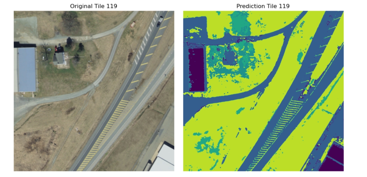
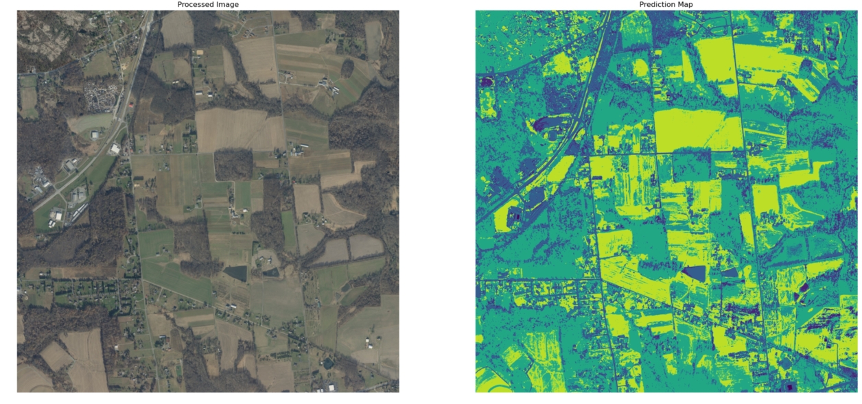
This project aims to develop a machine learning based pipeline for detecting land cover changes in Chester County’s East Nottingham region, leveraging aerial imagery from 2018 and 2021. The focus is on automating the traditionally labor-intensive process of monitoring land changes, which is crucial for urban planning, environmental conservation, and disaster response. Using unsupervised (K-means) and supervised (U-net) learning techniques, the study seeks to enhance the accuracy and efficiency of change detection methods, contributing to the region’s sustainable management.