
Philadelphia, like many older cities, has begun to recognize that a well-maintained trail system along the central Delaware River will provide the city, residents and property owners with multiple benefits. A continuous, 7-mile trail along the central Delaware will offer a fun recreational destination for the city’s residents, whether they are walkers, joggers, bikers or river watchers. The trail will connect river neighborhoods and, over time, will connect to a network of trails along the northern Delaware and the Schuylkill. These miles of trails will answer growing public demand for safe and pleasant ways to travel about the city, allowing residents to get to work or school, shop, do errands and reach other riverfront destinations away from traffic. Offering river trails on the Delaware, as we already do on the Schuylkill, will increase the health of our city by allowing residents more opportunities for outdoor recreation and creating more educational opportunities for students.
Trails are relatively inexpensive public investments compared to road and sewer infrastructure, but their economic-development potential is great. The Schuylkill River Development Corporation estimates that the $170 million public-sector investment in the central portion of the Schuylkill Banks trail will result in $2.4 billion in private investment over the next five to ten years. Indianapolis spent $6 million to build the 10.5-mile Monon trail through its downtown in 1999. In its first ten years, the trail has attracted close to a billion dollars along its downtown route, bringing thirty new businesses and various public and private revitalization projects along its corridors. An estimated 1.2 million people use the trail annually for walking, biking and roller-blading (17). In Seattle, a 12-mile recreational trail increased property values and added a new attraction that created great demand for new properties in proximity to the trail (18).

Wherever possible, the trail will be built within a greenway, a 100-foot band of green along the river’s edge that will offer users scenic views. (Further discussion of the greenway can be found in section nine.) While the greenway’s primary function is to clean the river’s edge and improve water quality, it will also provide an attractive, natural trail setting. Where security or business requirements or the absence of land at the water’s edge make this greenway impossible, the trail will be diverted back to a public road or perhaps will continue over the water on a boardwalk.
To create a continuous trail along the central Delaware, where most of the land is privately owned, will require clear zoning rules for redeveloped sites and strong partnerships with riverfront owners. Cities have typically used three methods to obtain permission to create a trail over private land:
- Obtain a right-of-way by making it a requirement for new development. Philadelphia’s zoning code can require owners seeking zoning and building permits to redevelop their property to provide a setback along the river for a greenway and trail. Overall project densities will still be based on the entire site area, including the portion dedicated to the greenway, so that there is no loss in development rights or potential. Where this is not possible, owners seeking permits can be required to provide a right-of-way along another identified route. In other cities, when owners submit a site plan to city agencies for review, they identify where a trail will be located that meets city standards. In exchange for building and zoning permits, they allow the creation of a trail across their land. Where this isn’t possible, the owners seek a variance from the requirement. Requiring a trail (or greenway) as a condition of development approval is a valid use of city power because the requirement affects the placement of building on a property but does not prohibit development or remove all or most of the economic value of the land. In exchange for zoning and building permits, the city should also explicitly request a public-access easement that gives the public the legal right to use the trail.
- Request that owners without redevelopment plans provide a right-of-way for a trail in return for federal tax deductions and other incentives. Owners without imminent plans to redevelop should be asked to participate in a new central Delaware trail program by donating a conservation easement for a public trail across their property. Conservation easements (19) offer the best tool through which to permanently protect a right-of-way for recreation and conservation while compensating the owner with federal tax deductions (20). Owners should be provided with multiple local and federal incentives to dedicate a portion of their private land for public benefit. Through successful public-private partnerships, many miles of recreational trails can be added each year. The easement can set limitations on the public’s use of the trail, forbidding, for example, motorized vehicles or alcohol. The public can address the liability concerns of owners by assuming responsibility for the “care, custody and control of the public trail” (21).
- Where owners will not participate in the central Delaware trail program by donating a right-of-way, the city can purchase rights-of-way over privately owned land. The waterfront manager or city determines whether the owner will sell a portion of the land or a public-access right-of-way. While the city cannot possibly afford to buy an easement over every parcel of land along the riverfront, this is an option for some key parcels.
Trails in Philadelphia and peer cities are typically designed to be 12 to 20 feet wide, with six-foot planted shoulders on each side of the trail to absorb stormwater and create an attractive path. Good lighting, emergency phones and frequent patrols are important to keep the trail safe. Two high-crime cities that have implemented these safety measures, Detroit and Hartford, have not experienced a single violent crime on their trails (22). Maintenance of the trail will ensure its safety for users.
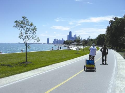
Chicago's trail runs for over 20 miles along Lake Michigan.
Short-Term Actions (2008-2012)
- Announce central Delaware trail program and ask owners to participate.
- Pass a zoning overlay that requires a setback from the water’s edge for a greenway and trail, public access and unobtrusive parking.
- Support Center City District in its creation of an immediate trail from Wal-Mart to the Benjamin Franklin Bridge to bring people to the river for recreation.
- Identify incentives for owners without redevelopment plans to provide rights-of-way for trail in the form of conservation easement (in addition to federal tax deductions). A proposed list of incentives is on page 47.
- Create quick and painless procedures for owners to donate legal rights-of-way for the trail to the city or waterfront manager and for the city to indemnify owners from liability for injuries on trails and greenways that run across privately owned land.
- Identify trail width, materials, stormwater infiltration measures and safety features to allow owners and waterfront manager to create consistent design.
- Acquire rights-of-way over privately owned land in exchange for zoning and building permits and indemnification of owners from liability for injuries on their land.
- Acquire rights-of-way from riverfront owners who voluntarily provide rights-of-way in exchange for incentives.
- Take advantage of any immediate opportunities to build initial permanent segments of the trail that may arise from development proposals or available funding.
- Identify where alternate trail routes are needed due to national security or harm to existing businesses.
- Wherever possible, reach agreements with state agencies, utilities, city agencies, river authorities, the Delaware Valley Regional Planning Commission (DVRPC) and other funding agencies to make public access to the river a condition of grant awards or infrastructure projects, as it is for all property that leases state riparian land.
Longer-Term Actions (2012-2018)
- Design and build alternate routes for trail along road or over water where needed.
- Build safe, well-designed and permanent trail segments.
- Create rental facilities for bicycles and other recreational equipment and refreshment areas. These concessions can help fund maintenance and improvements to the trail.
- Once a trail through Center City is complete, create a historic tour using personal cell phones. A historic tour using personal cell phones and other digital media can be offered inexpensively to highlight the historic places and events along the central Delaware, including America’s first European settlements, the founding of the United States military and the beginnings of American industry.
Civic Actions: What Philadelphians Can Do
- Make preserving land for a trail and providing a public-access right-of-way a part of every community benefits agreement.
- Approach owners with whom you have a relationship about their donating or selling a right-of-way or conservation easement in return for tax benefits and other incentives.
- Offer awards or other forms of recognition to owners who donate rights-of-way or take other action to support a public riverfront.
- Inform residents that density on the riverfront makes sense for the river when it is paired with trails, greenways and parks.
- Meet with citizens in neighborhoods on the northern Delaware and Schuylkill Rivers to share experiences, and learn from those who have been working on reinventing riverfronts for years.
Benefits and Impact
Economic: An asset with strong economic-development potential, the trail will attract employers, knowledge workers, families and empty nesters to live and work in the city (23).
Environmental: The trail will provide alternative modes of transportation without emissions, bring people to water and a natural greenway, create new relationships between Philadelphians and the river and promote private management of public space.
Community: The trail will connect river neighborhoods, create new recreational opportunities for health and fitness, improve quality of life and provide educational opportunities for children.
Impact on City Budget: Cost estimates for building the trail are based on the best local example, Schuylkill Banks. Estimates include landscaping, trail connections and construction. The estimated cost for trail design and construction from West River Drive to South Street, with improved connections to the South Street Bridge, was $9.4 million ($2,192,000 design, $7,208,000 construction). The extension of the trail from South Street to Bartram’s Garden is estimated at $6.8 million. The trail is 18 feet wide (14 feet of asphalt with a 2-foot shoulder on each side) (24).
Maintenance Costs for Trail, Greenway and Park Space: A study of New York City’s waterfront public-space maintenance costs, including the trail, greenway area and park space, found that the average cost per acre per year is $55,000 for maintenance and landscaping and $18,000 for security (25). The replacement or repair of docking, bulkhead, benches, drinking fountains, lighting, pavement and railway costs an additional $15,000 an acre per year.
Other Cities Have Done It - We Can Too
When you think of New York City, your first thought may be of tall buildings, Broadway theater or great restaurants. But the city’s boroughs have been working for the last two decades to build trails and greenways along its rivers. Like Philadelphia, but with a twenty-year head start, Manhattan is building a greenway and trail along the water’s edge around the entire island and is redeveloping former riverfront industrial properties into areas with trails and parks. While some of the river land was publicly owned, most of it was privately owned. New York has had great success with its appeal to owners to donate rights-of-way and has achieved high levels of participation in its greenway and trails program. We can, too.
Funding Resources
- Funding has already been approved for the Center City District to create an immediate interim 2-mile trail along the river. The William Penn Foundation made the grant in 2007.
- City Capital Funding: Virtually all city waterfront trails in peer cities rely to a certain degree on the city’s general operating budget and park personnel.
- Take Me to the River Grant Program (Delaware Valley Regional Planning Commission, or DVRPC): A $1 million grant pool is available for projects to improve riverfront areas.
- Trump Tower and Penn Treaty Tower riparian lease agreements:Under the state’s riparian land lease, Trump and Penn Treaty Towers must dedicate 50 cents for every square foot of building space for implementing the Civic Vision for the Central Delaware. Based on the square footage of plans submitted to the Philadelphia City Planning Commission, this will create a one-time payment of approximately $350,000 (26).
- Private Donations: One strategy that Philadelphia has used to fund large projects such as the Avenue of the Arts (an improved section of Broad Street) is to form a partnership with a group of private donors who provide seed money and show significant community support.
- Tax Increment Financing District (TIF): As noted on page 15, a TIF is a tool for closing funding gaps. It allows tax revenues to be deferred and instead used to pay for the cost of redevelopment. A TIF could provide consistent funding for trail creation and maintenance. Pennsylvania TIF legislation requires that TIF dollars be spent only in the district. Residential properties with ten-year tax abatements will not contribute to the TIF until the expiration of the tax abatements.
- Transportation Enhancements (Pennsylvania Department of Transportation, or PennDOT): This annual program funds the creation of bicycle and pedestrian facilities.
- Recreational Trails Program (PennDOT): Awards grants to develop and maintain recreational trails and trail-related facilities and to acquire easements and properties. Typical grant is about $150,000.
- Coastal and Estuarine Land Conservation Program and National and Estuarine Research Reserve System (National Oceanic and Atmospheric Administration): Gives funds to states for land acquisition, research and educational activities on lands sheltered from development to provide waterfront access. Maximum grant is $3 million; a 100 percent match is required.
- Pennsylvania Recreational Trails Program (Pennsylvania Department of Conservation and Natural Resources, or DCNR):Funds development and maintenance of recreational trails through the Federal Highway Administration. A total of $300,000 is available for non-motorized trails only. Applicant must provide 20 percent match.
- Balance Bar Community Grants Program (Balance Bar Food Company): Funds projects that provide community residents the opportunity to lead healthy, active lifestyles. Up to $25,000 per grant.
- Fees for Events, Concessions and Parking: These fees can generate substantial revenues.