Land-use Classification Using Semantic Segmentation
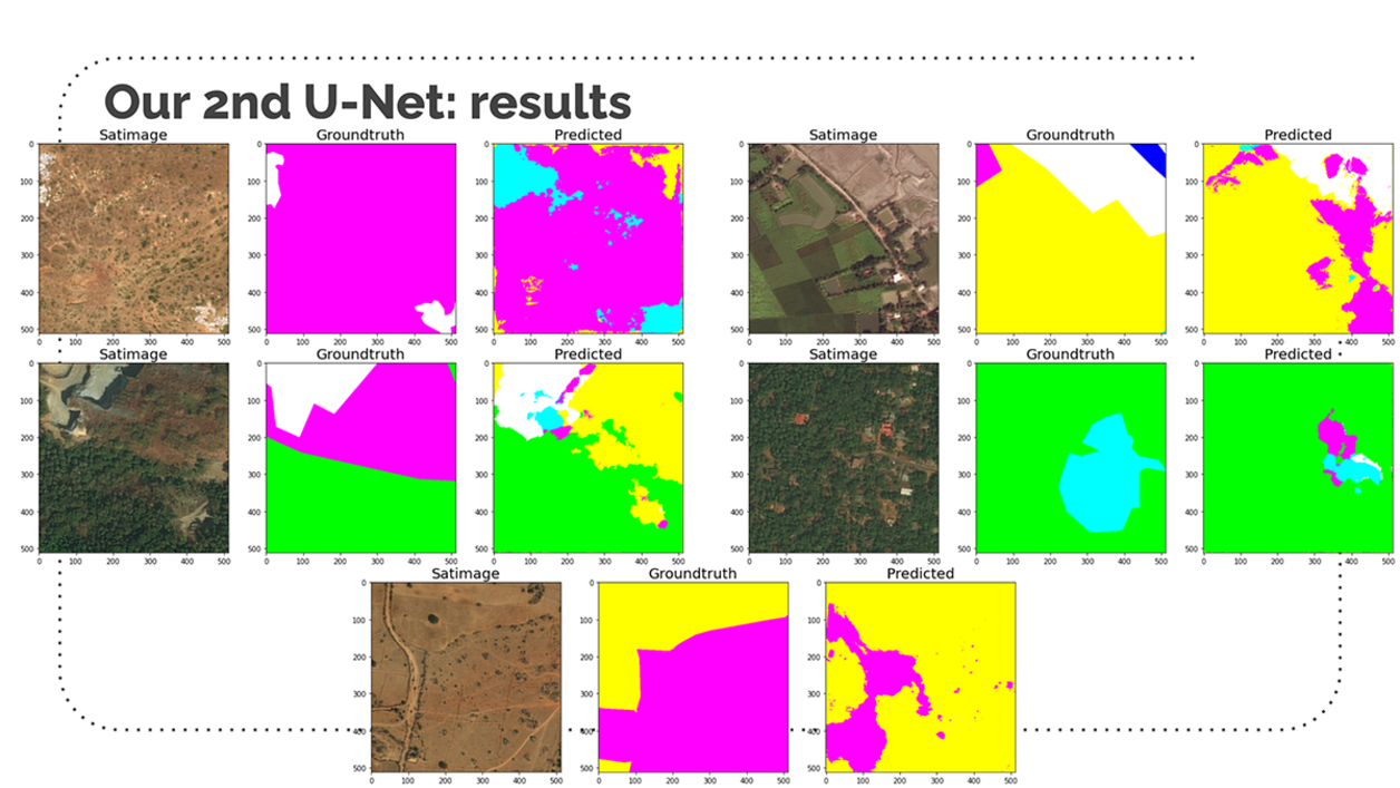
Land Use/Land Cover (LULC) data are an important input for ecological, hydrological, and agricultural models. The National Land Cover Database (NLCD) is developed by the USGS from Landsat imagery. However, these data have traditionally have large temporal gaps (~5 years) as they are computationally intensive to create. More temporally granular land cover data are needed for a studying a rapidly changing environment. We believe we can solve the problem through the use of Semantic Segmentation, a form of dense prediction where every pixel in an image is given a label of a corresponding class. Semantic Segmentation has become prevalent in both the medical field as a way of identifying harmful cells from healthy cells in brain and organ scans, and autonomous driving cars being able to identify free road space from other vehicles, pedestrians, and road signs. However, there has also been a growing application of Semantic Segmentation to the field of Remote Sensing and identifying different classes of land use and objects from satellite imagery.
Learn more about this project:
GitHub link
Website link
R Markdown link