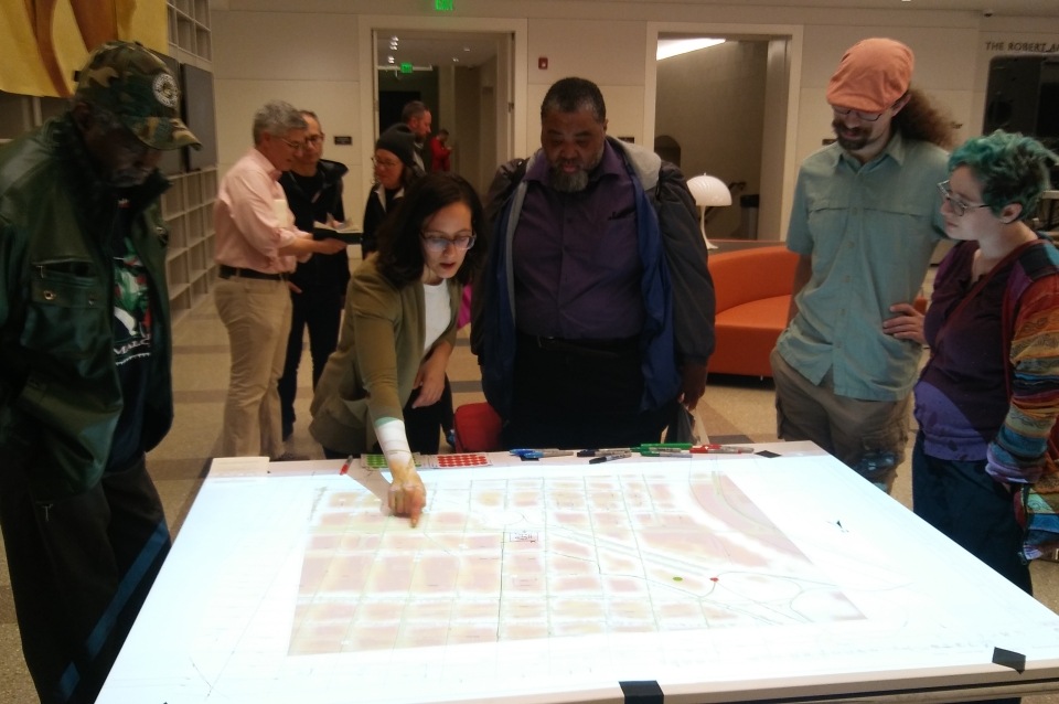
In collaboration with the University of Pennsylvania Libraries Map Room, the Architectural Archives did a map room event at the Free Library of Philadelphia as part of the Archives Month Philly event at the Central Branch. Inspired by the St. Louis Map Room Project, the Philadelphia Map Room is “an experiment in collaborative mapping as a source of community engagement.” The activity helps illustrate how subjective experience of place intersects, challenges and are influenced by historical and environmental processes.
A basic reference map of the Benjamin Parkway area of Philadelphia was laid on a table. Participants used markers to draw their path to the Free Library that day. They, then mark points of frustration and/or joy and interest on their way here. Then, openly available GIS data of pedestrian/cycling patterns, SEPTA routes, trees, park, and flood zones were projected on to it for further insight. This activity gave participants insight into the ways designers (our example was Lawrence Halprin’s designs for public spaces) analyze and visualize public spaces to make design decisions. The activity also illustrated on how urban design decisions affect everyone’s everyday use of the space, how you feel when you are in it, and how it dictates the way you move through a city.

 View Slideshow