Stuart Weitzman School of Design
102 Meyerson Hall
210 South 34th Street
Philadelphia, PA 19104
Get the latest Weitzman news in your Inbox
 Expand Image

Media Contact
Michael Grant
mrgrant@design.upenn.edu
215.898.2539
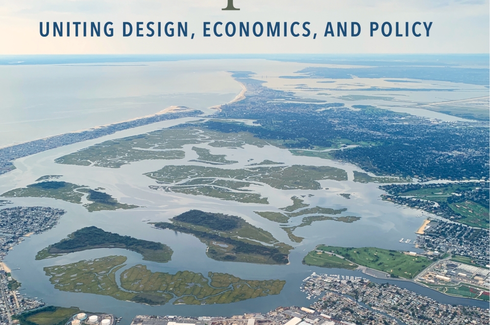
Tens of millions of Americans are at risk from sea level rise, increased tidal flooding, and intensifying storms. The design and policy decisions that have shaped coastal areas are in desperate need of updates to help communities better adapt to a changing climate. A Blueprint for Coastal Adaptation (Island Press, 2021), a new volume co-edited by Weitzman's Billy Fleming, Wilks Family Director at The Ian L. McHarg Center for Urbanism and Ecology, with Carolyn Kousky, executive director at the Wharton Risk Center, and Alan M. Berger, identifies a bold new research and policy agenda and provides implementable options for coastal communities. Among the coastal adaptation experts who discuss the interrelated challenges facing communities experiencing sea level rise and increasing storm impacts in the book are Karen M’Closkey, associate professor of landscape architecture, and Keith VanDerSys, lecturer in the Department of Landscape Architecture. They are also the cofounders of PEG office of landscape + architecture.This selection appears in Chapter 3, “For Whom Do We Account in Climate Adaptation.”
With each new report, and each revised model and map, the situation becomes more dire—tens of millions of people in the United States will be inundated by sea level rise and many more millions are at risk of annual flooding, irrespective of sea level rise.(1) There are numerous, and entangled, reasons that this is so: at the federal level, it is due to flawed mapping methods that determine flood zones, as well as ineffective and inequitable flood management and mitigation programs. At local levels, it has to do with poor land use decisions based on short-term thinking and the prioritization of private property over long-term public good. As sea level rise drives people away from coasts, the numbers impacted by flooding will actually increase if we fail to address what cartographic expert Mark Monmonier calls the “third shore- line” of low-lying noncoastal areas. Ignoring this third shoreline is a mistake. As people move inland, the amount of impervious surface increases, causing higher runoff volumes and oversaturated ground. With increasingly volatile storms caused by a warming climate, higher quantities of rain will fall in shorter durations, greatly exacerbating flooding everywhere.
While it may seem obvious that coastal adaptation strategies should be designed in tandem with broader climate adaptation plans for inland areas, this type of coordination is not happening. To explain why, we first focus on how mapping and floodplain designations have enabled development to occur where it should not. Then we outline why redevelopment of these areas continues, highlighting inequities embedded in coastal regulations and post-disaster financing. Lastly, using our participation in the Resilient by Design: Bay Area Challenge as a case study, we argue that organized and equitable adaptation through “managed retreat,” or relocation, has as much to do with housing policy, jobs, and income—the things that make it possible for people to move—as it does with mapping and floodplain policies.(2)
Mapping the Floodplain
Seemingly purely technical issues like how to name things and how to store data in fact constitute much of human interaction and much of what we come to know as natural.(3)
There is nothing natural about how a floodplain is designated. The descriptions of probability of storm events, as well as mapping inaccuracies, lead people to underestimate or misunderstand their flood risk. According to the Federal Emergency Management Agency (FEMA), 13 million people in the United States are at risk of serious flooding from hurricanes and surge (coastal flooding), swollen rivers and streams (fluvial flooding), or because rainwater gets trapped and has nowhere to go (pluvial flooding). Between 2008 and 2017, eight out of ten states with the highest number of declared flood disasters were landlocked states.(4) A more recent study shows that the number of people at risk has been greatly underestimated—it is projected to be three times higher than previously thought, putting over 40 million people in the 100-year floodplain.(5) This was “discovered” simply because researchers looked more closely at the landscape itself with a finer grain of detail than FEMA’s maps. And these statistics have nothing to do with sea level rise. In fact, FEMA’s maps—Flood Insurance Rate Maps (FIRMs)—do not account for climate change at all, and their accounting for pluvial flooding is spotty.(6) FIRMs are made for insurance purposes only; they describe generalized conditions and are not based on a thorough assessment of flood hazard for any individual property or area. Mapping resolution is uneven from one place to the next. To create FIRMs, for example, the number of transects (which equates to level of accuracy) is based on population density (more people equates to more transects) and not on landscape morphology, and the maps do not consider significant factors such as erosion rates or land subsidence. Moreover, as a consequence of funding shortfalls and bureaucratic inaction, by some estimates only one-third of streams and coastlines have been mapped and, of those maps, 58 percent are out of date. One stark example is a comparison between a post–Hurricane Katrina map of Jackson County, Mississippi, and a pre-Katrina map of the adjoining Mobile County, Alabama. The maximum flood height shown on the two maps had a fourteen-foot difference between them—for the same location along their shared border.(7) That is the difference between life and death. Clearly, more recent and detailed data are urgently needed to make better maps.(8)
However, the problem is not simply one of accuracy: it is with the map classifications themselves—that is, the drawing of lines to demarcate what are inherently fluid and shifting conditions. The agreed-upon lines—for example, between a 100-year and a 500-year storm event—are arbitrary.(9) They are statistical probabilities and are based on outmoded rainfall data, which are not a good predictor of future storms. As the frequency and intensity of storms change, the lines will shift, or at least theoretically they should. Unfortunately, floodplain designations are understood as an explanation of actual conditions so people may believe they are “in” a 100-year versus a 500-year zone, as if those designations are real. However, these imaginary flood lines become real and fixed as the financial mechanisms of flood insurance start to solidify around them, followed by the construction of roads, buildings, and utilities.
Once in place, it is difficult to curb or abandon development—people have made their lives and livelihoods in these areas, and when disaster strikes, everyone, including the government, pitches in to help rebuild. Unfortunately, this cycle of risky building puts more and more people in precarious situations, some of whom are much more vulnerable than others. As we outline, though the insidious classifications having to do with mapping coastlines and floodplains may seem only tangentially related to the injustices of racial and economic divisions, they are in fact directly related. The mapping processes and policies have inequity built into them.
Building in the Floodplain: Insurance and Disaster Financing
FIRMs are a significant component of floodplain management. The inaccurate mapping practices used to create FIRMs provide the basis for the regulations created by the National Flood Insurance Program (NFIP). The NFIP, for instance, requires participating communities to adopt minimum construction standards and land use regulations in high-risk zones (100-year). However, FEMA rarely penalizes communities that fail to enforce these regulations, and many regulations have not been updated since the 1980s. Furthermore, the regulations were not strong enough to begin with. Within the first few decades after the establishment of the NFIP in 1968, 2.3 million homes were built in floodplains because the strict conditions that were initially conceived to limit such development were not put into policy.(10) Over 25 percent of NFIP claims are outside of so-called high-risk flood zones and receive one-third of federal disaster assistance for flooding.(11)
In an excellent article called “Why Coastal Regulations Fail,” the authors point to the flaws in each of the four major federal programs for coastal management—NFIP, US Coastal Barrier Resources Act, Coastal Area Management Act, and the Stafford Disaster Relief Act—and demonstrate how they can work at cross-purposes with each other.(12) The Stafford Act (1988), in particular, rewards high-risk development, undermining the other coastal management policies. When a presidential disaster declaration is made, FEMA pays 75 percent of reconstruction costs.(13) Communities that are ineligible for government- subsidized flood insurance (i.e., they do not participate in NFIP) are still eligible for public disaster relief funds through the Stafford Act when floods do occur. Such regulatory conflicts inadvertently encourage high-risk development in flood-prone areas since redevelopment is paid for by the public tax dollars that fund federal disaster assistance. Moreover, individuals and communities can avoid the NFIP insurance requirements by “removing” property from the floodplain by building levees.(14) As we see later, this does not lessen the potential of disastrous flooding from heavy rains.
Another problem is that FIRMs reinforce a mindset that puts property over people, and individual property over public property. For example, the finish-floor elevation of a building governs whether a property is “in” or “out” of a flood zone, rather than the street elevation being the determining factor for limiting development. This is problematic from a life safety perspective and because it encourages rebuilding in the same place, albeit with elevated building structures, thus perpetuating the cycle of low-lying development. So-called “repetitive loss structures” account for 20 percent of NFIP-insured properties.(15) Perhaps the biggest failure occurs in post-disaster replacement of the critical public infrastructure that supports private building development; FEMA’s assistance via the Stafford Act only covers repairs equal to pre-damaged conditions, which gives no incentive or ability to upgrade or move roads and utilities.(16) In other words, the NFIP may have contributed to better individual building regulations, such as sturdier foundations and elevated floors, but it did not lead to better development regulations.
Current floodplain regulations and disaster funding mechanisms end up privileging wealthier owners rather than renters and low-income homeowners. In 2017, homeowners received $35 billion in disaster relief while renters received only $1 billion.(17) FEMA data from Hurricane Harvey show that low-income Individual Assistance applicants were disproportionately denied payouts—though they comprised 28 percent of the applicants, they accounted for 48 percent of the rejected claims.(18) After Superstorm Sandy, renters received only 22 percent of the federal funding yet accounted for 43 percent of the dam- age.(19) Even in cases where FIRMs have overestimated flood risk, causing huge increases in insurance premiums, only wealthier communities can pay to hire private companies to do a more detailed risk analysis to challenge FEMA’s assessment.(20) Not only is there disparity in terms of who gets funds for post- disaster flood damage, there is also discrimination in terms of who gets federal buyouts to relocate out of the way of future disasters. These buyouts have gone disproportionately to wealthy, white homeowners.(21) Yet, even if there were more equitable numbers in terms of who receives money to relocate, buyout pro- grams alone are not scalable to the task of moving millions of people.(22) There are some inspiring examples of community-led, government-supported buyouts, but there have been just over forty-three thousand voluntary buyouts over the past three decades.(23) Imagine scaling this up by a factor of one thousand over the next few decades, and that is the scale of relocation that would be necessary if the goal were to have no one living in the “100-year” floodplain as it is currently designated. We need to think at this scale of relocation because, with three feet of sea level rise, the current 100-year floodplain will be the new “sea level” in many coastal areas, not considering storms or surge.
These are just some examples of how coastal management policies and insurance and disaster financing contribute to wealth and racial divides. As the need for large-scale migration to safer areas becomes more accepted (or we wait until we have no choice), these inequities will only be exacerbated unless policies are put in place to prevent it.
1. Mathew E. Hauer et al., “Millions Projected to Be at Risk from Sea-Level Rise in the Continental United States,” Nature Climate Change 6 (July 2016): 691–95.
2. The nine-month competition was sponsored by the Rockefeller Foundation. The authors led the University of Pennsylvania part of Team BIONIC, which is a San Francisco–based firm led by Marcel Wilson. Other team members included WXY; Michael Yarne; Enterprise; Moffatt & Nichol; WRA; RMA; Romberg Tiburon Center, SFSU; Studio for Urban Projects; RAD Urban; and Keyser Marston Associates. There were dozens of other consultants and numerous meetings with individuals, organizations, city personnel, and others. From Penn, we would like to thank students from the Landscape Architecture and City Planning departments who helped with data collection and drawing; Allison Lassiter for rallying the city planning students; Ken Steif for work on the housing policy; Michael Luegering and Michael Tantala for data analysis and flood modeling; and Billy Fleming and Ellen Neises for sharing their experiences from the 2013 Rebuild by Design competition. The opinions about the shortcomings of the competition and project are the authors’ only and should in no way be assumed to be shared across all project participants.
3. Geoffrey C. Bowker and Susan Leigh Star, Sorting Things Out: Classification and Its Consequences (Cambridge, MA: MIT Press, 1999), 326.
4. These are disasters declared by the president of the United States. See Laura Lightbody and Forbes Tompkins, “Where It Rains, It Floods,” PEW (January 25, 2018), https://www.pewtrusts.org/en/research-and-analysis/articles/2018/01/25/….
5. Oliver E. J. Wing et al., “Estimates of Present and Future Flood Risk in the Conterminous United States,” Environmental Research Letters 13 (2018), https://iopscience.iop.org/article/10.1088/1748-9326/aaac65.
6. First Street Foundation, “FEMA Flood Maps and Limitations,” June 7, 2019, https://medium.com/firststreet/fema-flood-maps-and-limitations-ea06bf10….
7. Michael Keller et al., “Outdated and Unreliable: FEMA’s Faulty Flood Maps Put Homeowners at Risk,” Bloomberg, October 6, 2017, https://www.bloomberg.com/graphics/2017-fema-faulty-flood-maps/.
8. William J. Neal et al. “Why Coastal Regulations Fail,” Ocean & Coastal Management 156 (2018): 21.
9. The naming of storm events by probability causes much confusion, leading some to believe that a 100-year storm happens once every hundred years; rather it is a probability in any given year. For example, a 10-year storm has a 10 percent probability of occurring in a given year, a 100-year storm event has a 1 percent probability in a given year, and a 500-year has a 0.2 percent probability.
10. Gilbert M. Gaul, The Geography of Risk: Epic Storms, Rising Seas, and the Cost of America’s Coasts (New York: Sarah Crichton Books, 2019), 134.
11. FEMA, “Fact and Myths about Flood Insurance,” https://www.fema.gov/news-release/20200220/fact-sheet-myths-and-facts-a….
12. Neal et al., “Why Coastal Regulations Fail,” 24.
13. Neal et al., “Why Coastal Regulations Fail,” 24.
14. Monty Schmitt, “FEMA, Floodplains and Fish: Why the National Flood Insurance Program Must Protect Floodplains to Improve Public Safety and Safeguard Endangered Species,” Coalition for Sensible Safeguards, https://sensiblesafeguards.org/fema-floodplains-and-fish-why-the-nation….
15. Repetitive loss properties are those that have made two insurance claims over one thousand dollars within a ten-year period. The number of properties subjected to repeated floods would be much higher if it included properties without NFIP insurance.
16. For an overview of all federal flood policies and programs (not limited to FEMA and NFIP), see “National Flood Programs & Policies in Review,” Association of State Floodplain Managers (2015), https://asfpm-library.s3-us-west-2.amazonaws.com/ASFPM_Pubs/ASFPM_NFPPR….
17. Alice Bucknell, “The Unstable Condition: What the Pandemic Can Teach Us about the Need for More Affordable Rental Housing,” Harvard University GSD News, May 1, 2020, https://www.gsd.harvard.edu/2020/05/the-unstable-condition-what-the-pan….
18. Amelia Adams’s response to “Digital Dialogue No. 4: Improving the Disaster Recovery of Low Income Households,” Wharton’s Risk Management and Decision Processes Center, https://riskcenter.wharton.upenn.edu/digitaldialogues/improvingdisaster….
19. Yvette Chen and Adam Gordon in “Digital Dialogue No. 4: Improving the Disaster Recovery of Low Income Households,” Wharton’s Risk Management and Decision Processes Center, https://riskcenter.wharton.upenn.edu/digital-dialogues/improvingdisaste….
20. Annie Aviles, “Off the Map,” Pacific Standard, January 15, 2019, https://psmag.com/magazine/off-the-map-coastal-flooding-maine-east-coas….
21. Rebecca Hersher and Robert Benincasa, “How Federal Disaster Money Favors The Rich,” NPR, https://www.nprillinois.org/post/how-federal-disaster-money-favors-rich….
22. Liz Koslov has argued that retreat (relocation) should be seen as an opportunity and not a last resort. Liz Koslov, “The Case for Retreat,” Public Culture 28, no. 2 (2016): 359–87.
23. Mathew E. Hauer et al., “Sea-Level Rise and Human Migration,” Nature 1 (January 2020): 32. For a thorough analysis of the buyout program, see Katharine J. Mach et al., “Managed Retreat Through Voluntary Buyouts of Flood-Prone Properties,” Science Advances 5, no. 10 (October 9, 2019), https://advances.sciencemag.org/content/5/10/eaax8995/tab-pdf.
© 2021 Carolyn Kousky, Billy Fleming, and Alan Berger.