I spent this summer working on Pecos Pueblo, an Ancestral Puebloan site outside of Santa Fe, New Mexico, in Pecos National Historical Park. At its height, Pecos Pueblo was a powerful economic hub for the indigenous Southwest. Starting in 1350 C.E., communities in the area began consolidating into a unified pueblo atop Pecos Mesa, constructing a two- to four-story structure of over six hundred rooms in a rectangular shape to surround a central courtyard. Situated on the easternmost frontier of the Ancestral Puebloan world, Pecos spawned trade networks spanning to the tribes of the Great Plains and served as a gateway through which goods could be transferred to other pueblos and communities in the Four Corners region. Between 1915 and 1929, Alfred V. Kidder, a Harvard archaeologist credited with the introduction of context-based and stratigraphic study to the field of Americanist archaeology, pioneered this new form of cultural data recovery through extensive excavation of Pecos Pueblo. The six years of archaeological fieldwork performed at Pecos successfully shifted the field from a pastime for gentleman pothunters to a scientific discipline in its own right. My work this summer focused on archival research on Kidder’s excavation and other archaeological and conservation work conducted on the pueblo, as well as on creating a high-accuracy basemap of the standing architecture in Pecos Pueblo for conditions assessment.
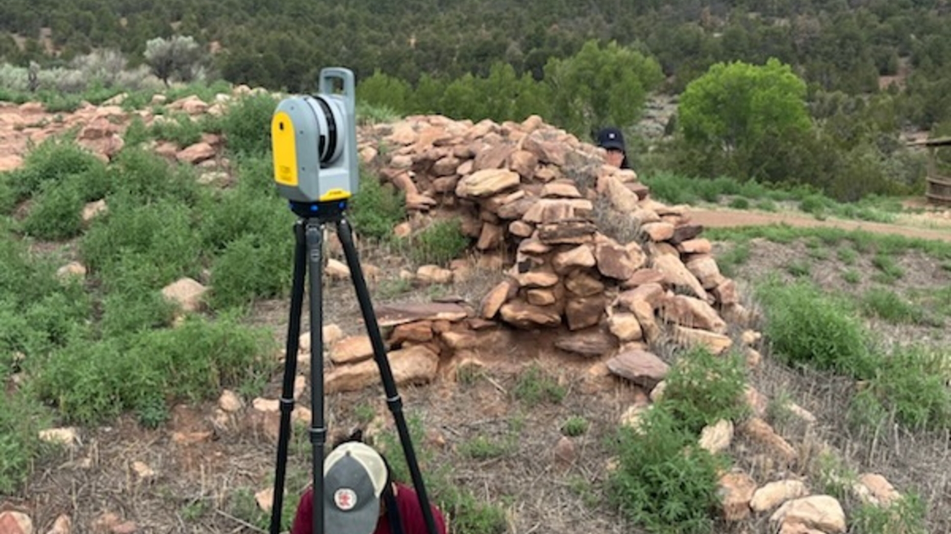
To assemble a comprehensive timeline of the stabilization history of Pecos, two archives were utilized: the Pecos National Historical Park archives and the Laboratory of Anthropology. Using these resources, we collected over five hundred historic documents and over two hundred historic photographs to aid in understanding the scope of the previous conservation work that had been performed on the architecture of the site. This documentation included Kidder’s original field notes, maps, and photographs from his archaeological work in the region. These historic resources will be compiled into a database of archaeological and conservation events at the site, which will allow stewards to easily generate room-by-room stabilization histories to aid in future preservation decisions. To create an architectural plan map, we used a Trimble X7 laser scanner to form a three-dimensional point cloud model of the standing architecture in Pecos Pueblo. Through this process, we experimented with methods and strategies for improving accuracy and efficiency in three-dimensional data collection. The raw data we produced from laser scanning the site totaled to five hundred gigabytes, so after fieldwork ended, I continued working with the point cloud to design effective methodologies for processing the data without exceeding computing limitations on file storage and processing power. The end result of this process is a high-accuracy and geolocated architectural plan map of the standing walls of the site that will be used to assess site conditions in the next phase of the project.

 View Slideshow
