I spent this summer interning with the Center for Architectural Conservation (CAC), where I contributed to the documentation and mapping of Tumacácori National Historical Park in Arizona. My work was divided between generating rectified elevation drawings from field photography and developing a comprehensive GIS-CAD integrated mapping system to align the site’s existing conditions with its historical evolution.
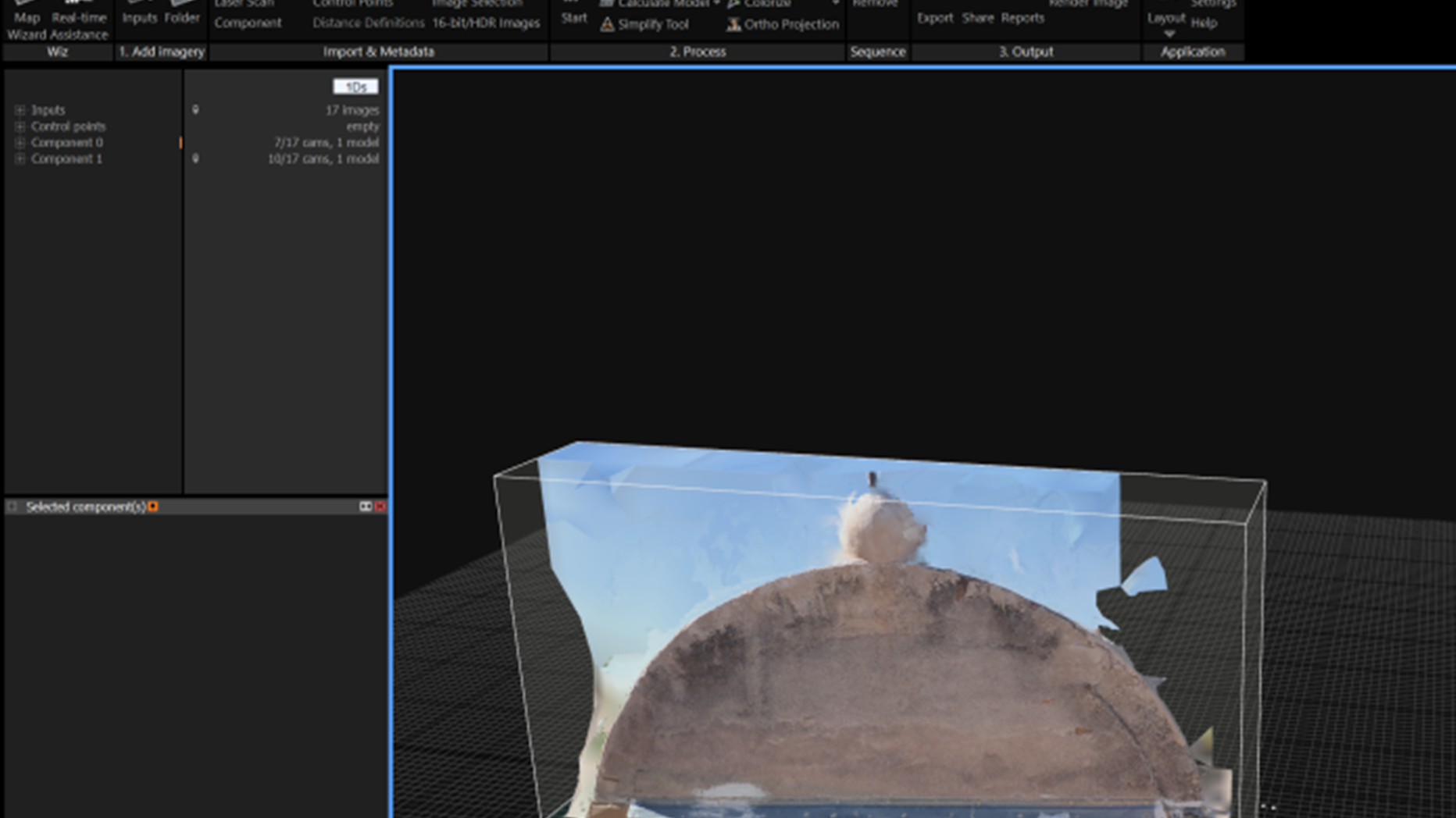
During the first half of the internship, my primary task was to use RealityCapture to produce interior and exterior orthographic elevations of the church, convento, granary, and other structures. In total, I generated 63 rectified elevations (Image 1), which required solving technical challenges such as missing data, alignment distortions, and lighting deficiencies in the interior photographs. These difficulties provided opportunities to experiment with projection orientation methods, manual control points, and post-processing techniques in Photoshop to refine the outputs.
In the latter half of the internship, I shifted focus toward mapping. Building upon the existing condition surveys and GPS points collected on site, I integrated ArcGIS Pro and AutoCAD Map 3D to align historical maps with present-day site conditions (Image 2). This workflow allowed me to accurately trace building footprints, site boundaries, and landscape features while assigning object-level attributes to improve future research usability. The result is a layered mapping system that consolidates changes in the site’s built environment across different historical phases, providing a valuable reference for scholars and conservation practitioners.
Overall, this internship not only strengthened my technical skills in digital documentation and mapping but also reinforced the importance of combining field data, archival sources, and digital tools to inform preservation practice.

 View Slideshow
