April 17, 2020
Stuart Weitzman School of Design
102 Meyerson Hall
210 South 34th Street
Philadelphia, PA 19104
Get the latest Weitzman news in your Inbox
Media Contact
Michael Grant
mrgrant@design.upenn.edu
215.898.2539
The Galápagos Islands are famous as a terrain of unmatched biodiversity, so rich in wildlife that they helped Charles Darwin formulate the theory of natural selection, which still underpins contemporary evolutionary biology. Today, 97 percent of the islands’ territory is protected land. And the notion of the Galápagos as pristine nature is so carefully guarded that, during boat tours, tourist groups are strategically kept at a distance from each other, as they circumnavigate the island chain, to promote a sense of immersion in the wild, says Dorothy Jacobs (MLA’19), an associate with Philadelphia-based firm Andropogon who traveled to the islands as part of a landscape architecture studio in 2018.
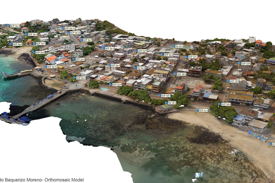
Meanwhile, the increasing pressures of ecotourism have begun to challenge the very wildlife that attracts tourists to the Galápagos in the first place. And the three percent of land that is home to the islands’ 30,000 human inhabitants has been subject to less international attention than the rest of the island chain. A Weitzman graduate studio, offered in 2017 and 2018 by Associate Professor of Landscape Architecture Karen M’Closkey with the title Fantasy Island, sought to address challenges related to population growth in the town of Puerto Baquerizo Moreno, on San Cristóbal Island. As part of the studio, students designed “areas of permeability” between the protected and human-inhabited parts of the islands. That work was collected in a booklet, and is being curated for a future exhibit in partnership with the Galápagos Education and Research Alliance, led by Michael Weisberg, professor and chair of philosophy at Penn.
Research that began in the studio gave rise to an independent data-gathering project led by M’Closkey and her partner, Keith VanDerSys, a senior lecturer in the Department of Landscape Architecture. That project is providing critical topographical data that will be used by Ecuadorian officials in climate resilience planning work on the islands’ shorelines.
Fantasy Island grew out of conversations between M’Closkey and Weisberg, whose initiatives with the Galápagos Alliance include community science, climate-resilient design, and public health. The Alliance has involved faculty from five schools at Penn, including Weitzman. And its primary focus has been on helping the people who live on the islands build a better understanding of the protected lands, which they are rarely able to access.
“Galápagos is not only sea lions and exotic fauna and flora,” says Ernesto Vaca, a Galápagos naturalist guide based in Ecuador, and co-director of the Galápagos Alliance. “Galapagos is also people. People need to live well in order to understand nature and embrace it. Protection requires benefits for people, and landscaping and design can help tremendously in achieving this.”
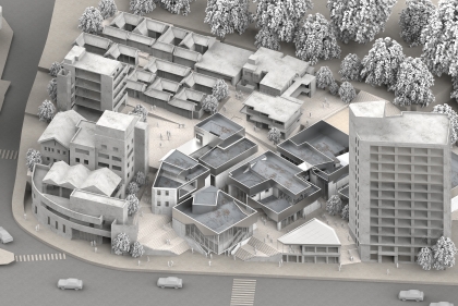
M’Closkey’s studio was intended, in part, to help strengthen the connections between Galápagos residents and their land. She wanted to explore what has been described as the “Galápagos Paradox” — how conservation and ecotourism have spurred population growth over the last thirty years. M’Closkey asked students to “engage the apparent dualisms arising from how the archipelago has been understood and managed, which is based on the construction of many oppositions and boundaries,” as she wrote in a booklet illustrating the students’ work. The students focused on creating public space amenities like parks and trail networks for Galápagos residents, while protecting land and water resources that are threatened by sea-level rise, extreme weather, and population growth and development trends. When students traveled to the islands in 2017 and 2018, they met with residents and officials about challenges and opportunities in the planning of Galápagos communities, M’Closkey says.
“We were looking at the land-water lines, the urban and national-park boundary lines, and the ravines from highlands to lowlands,” M’Closkey says.
Dorothy Jacobs, a Weitzman alum who took the studio in 2018, developed a design proposal called Defining Lines, which sought to correct the imbalance in tourism and ecological protection in the national park versus the inhabited areas. The location of the studio was the initial draw, Jacobs says. When she was able to visit, it became clear that the islands’ towns are left out of the image of the island promoted for tourism.
“You have this vision that no one lives on this island, that it’s remote, nature as it should be — perfect,” Jacobs says. “But a lot of the inhabitants haven’t even been to the park, or don’t know how to swim. There’s such a disconnect between the people that live there and the people that visit.”
So Jacobs designed a network of accessible trails to “puncture the psychological barrier” between the national park and the inhabited highlands of San Cristóbal Island, and to allow residents and tourists to explore the islands’ ecological, geological, and cultural features. Other students in the studio focused on promoting tourism in the highlands, establishing city parks, managing agricultural lands, and developing a “mega-pier” to serve both the tourism and fishing industries, among other proposals. Weisberg says that the Galápagos Alliance has shared a selection of the proposals with community members and officials, which is helping people on the ground visualize the future under different development and climate-change scenarios. The Alliance is also working on an exhibition of students’ designs and other research.
Fantasy Island has evolved into a research project for M’Closkey and VanDerSys and their firm, PEG office of landscape + architecture. When M’Closkey was putting the studio together in 2017, she went looking for topographic and bathymetric data for shoreline areas of San Cristóbal Island, in order to understand how tides interact with the land.
“I knew people would want work on the waterfront,” she says. “We were looking for how to make the topography and water elevations match up.”
The necessary data didn’t exist, so M’Closkey and VanDerSys are generating it themselves, with collaborators Michael Luegering and Michael Tantala, using ground surveying equipment and drones. They’re sharing the data with INOCAR, an arm of the Ecuadorian Navy, for use in projecting future sea-level rise and storm-surge impacts.
Meanwhile, the Alliance continues to build ties with local leaders. In March, the vice president of Ecuador, Otto Sonnenholzner, visited Perry World House for a speech and conversation with Weisberg about biodiversity protection and ecotourism. At that event, he praised the work that Penn Faculty and the Galápagos Alliance have done to promote local understanding of the island, according to a Penn Today report.
“You cannot love what you don’t know, and you will never take care of what you don’t love,” Sonnenholzner said, according to the report. “We have to start knowing what we have so that we can take care of it.”


 View Slideshow


