The EMLab is assisting the US Army Corps of Engineers with monitoring an experimental sediment placement on Sturgeon Island.
The EMLab's Keith VanDerSys and Michael Luegering use UAVs equipped with multispectral cameras to evaluate marsh vegetation recovery post-sediment placement.
The EMLab's Sean Burkholder uses GPS survey equipment to collect sediment elevations.
Before landscape architects can make decisions about how best to intervene in a landscape, they need data about the land itself: What its components are, how it moves, how it’s likely to change. Often, though, that data is collected by professionals in other disciplines, or government authorities with agendas of their own. Rather than taking that information for granted, says Keith VanDerSys, senior lecturer in landscape architecture, landscape architects can use emerging technologies to generate data of their own.
Much of what we know about global and regional environmental changes comes by way of environmental data, as either numerical or visual artifacts. “It so unbelievably conditions and shapes what we know and how we work,” VanDerSys says. “So if we can have some form of access to participate in shaping the data itself, and shaping the tools that we use for design, that allows us to tailor it to our needs as a field.”
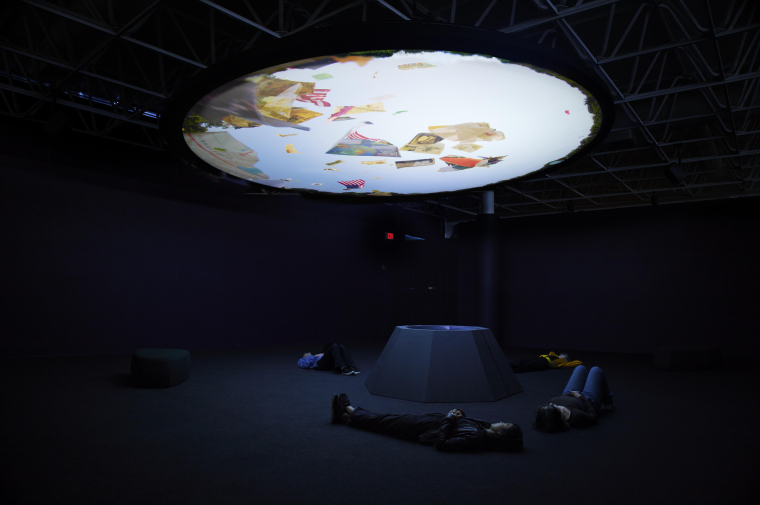
Generating and deploying data for landscape architecture—for mapping, modeling, and monitoring landscape change—is the unifying interest of the Environmental Modeling Lab (EMLab), an applied research unit of The Ian L. McHarg Center for Urbanism and Ecology at Weitzman. The EMLab is co-directed by four Weitzman landscape architecture faculty: VanDerSys; Andrew Gordon Assistant Professor Sean Burkholder, and associate professors Karen M’Closkey and Robert Pietrusko. Burkholder, who leads the Healthy Port Futures project in the Great Lakes, joined the Weitzman faculty in 2018. M’Closkey and VanDerSys are founding partners of PEG Office of Landscape + Architecture in Philadelphia. Pietrusko, winner of the 2021 Rome Prize in Landscape Architecture, joined the faculty this year from the Harvard Graduate School of Design. The Lab combines the research interests of its faculty directors and provides a vehicle for collaboration with other academic partners and consulting clients.
From February 15-18, the EMLab will present Instruments of Change, a three-day digital symposium “focused on the technological and scientific frontiers of sensing, simulating, and experimentation in the landscape.” Participants include scholars and practitioners from landscape architecture, ecology, planning, media studies, and representatives of the U.S. Army Corps of Engineers, with whom Burkholder and VanDerSys have collaborated. The three sessions will explore technology and methods for mapping, monitoring, and modeling changes in landscapes.
The tools the lab uses include a fleet of drones, multispectral cameras, water and sediment tables for landscape modeling, and a suite of advanced GIS software. That equipment can help build a more granular understanding of the characteristics of a space, says M’Closkey. But it can also help landscape architects investigate “the assumptions underlying information that we often take for granted.”
“We’re doing our own surveys, which means we can make our own maps and not rely on other maps that might not have the resolution of information we’re looking for,” she says. “But it’s also exploring, understanding all the interpretation that goes into the kinds of maps and models that landscape architects will typically use as their base files for projects.”
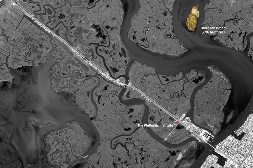
Exemplary projects for the EMLab include research that VanDerSys and M’Closkey have completed in the Galápagos Islands, to provide topographical data for the Ecuadorean government to use in climate resilience planning. That work began in a Weitzman School studio led by M’Closkey. VanDerSys and Burkholder also co-teach a seminar focused on using drones and other technology to monitor and map wetland areas at the New Jersey shore. Through the EMLab, the pair has worked with the Wetlands Institute in Stone Harbor, New Jersey, and the U.S. Army Corps of Engineers to analyze sediment placement at an island in the bays between New Jersey’s mainland and barrier islands.
“All the work really comes out of our intellectual interests and our research that happens within the context of studio,” VanDerSys says. “We’re always trying to find some kind of practical, real-world engagement for these ideas and how they impact our discipline.”
The EMLab is one of four faculty-led research groups within The McHarg Center, along with efforts focused on biodiversity, climate policy, and the urban public realm. The lab format gives the researchers flexibility to pursue academic projects or consultancy work outside the setting of a professional firm with paying clients. In a broader sense, M’Closkey and VanDerSys say, the lab’s work and the upcoming symposium are part of a push to incorporate new methods of research and representation in landscape architecture. In addition to moving beyond borrowed datasets and static renderings, new technologies can help designers understand and depict the dynamic processes that work together to create landscapes.
“Surveying as the first act of design has always been foundational to the discipline, but it is not something that many landscape architects do anymore,” M’Closkey says. “We either outsource it or, given the plethora of extant data and maps, we start with something that is pre-given. So what we are doing is not new. We’re just doing it with new tools that arise in tandem with a different set of environmental concerns than those of our predecessors.”

 View Slideshow