 Expand Image

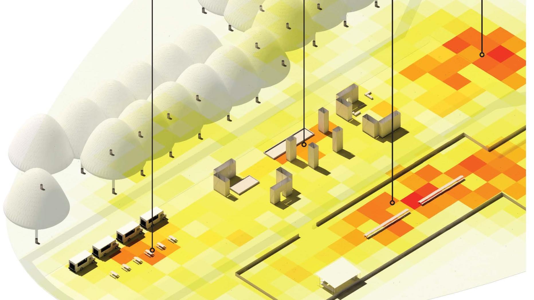
Spatial Analysis
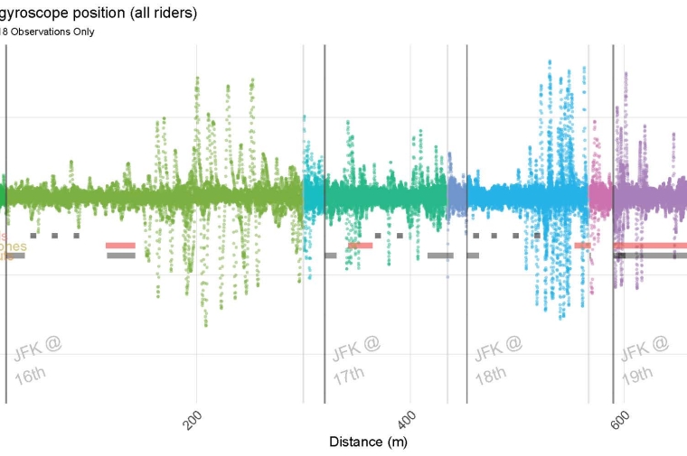
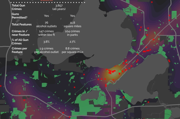
PennPraxis' data analysis process involves the creation of custom, open-source software tools to allow for reproducible, flexible, and complex analysis for a range of use cases related to planning, health, landscape and the built environment. Building geo-spatial and non-spatial routines in R brings some of the most powerful wrangling, visualization and statistical packages available. In analyzing the use of public space in Philadelphia, Praxis has combined survey research, behavioral spatial analysis, sensor data and open data into a unified data model to create n-dimensional understanding of the ways in which public space is used and understood.
Services include:
-
Multi-source data integration
-
Data mining
-
Smart city technologies
-
Survey design + analysis