
 Quantifying Seasonal Bias in Street View Imagery for Urban Form Assessment: A Global Analysis of 40 Cities
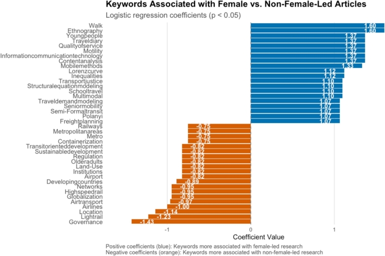 Exploring Gendered Research Patterns in Transport Geography
 Visualizing Neighborhood Change Through Time Series Clustering
 Uncovering Urban Factors of Homelessness Using AI
 When the Train Never Comes: Property Value Impacts from the Announcement and Cancellation of a Light Rail Project
 What Real Estate Listings Reveal About Who Applies for Mortgages
 Mapping Pedestrian-Level Heat Hazards in Philadelphia
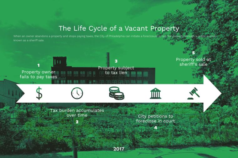 What's In A Vacant Lot: A Development Risk Assessment Tool
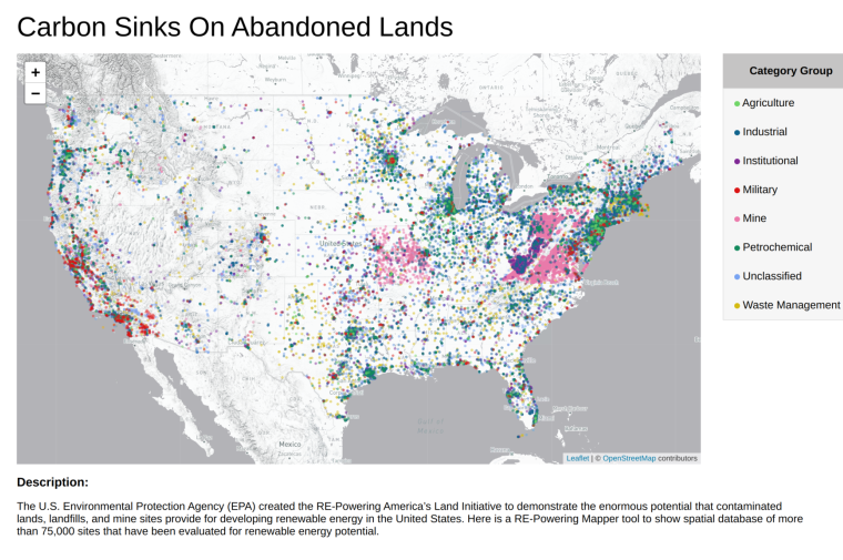 Carbon Sinks on Abandoned Lands
 A Sub-Meter Resolution Urban Surface Albedo Dataset for 34 U.S. Cities Based on Deep Learning
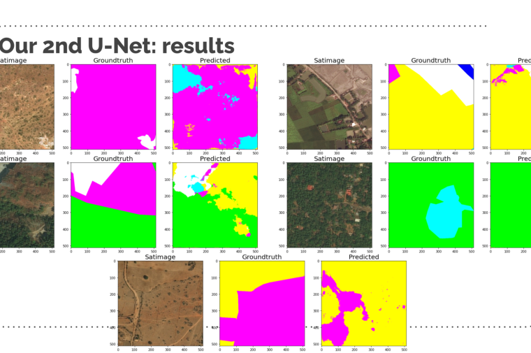 Land-use classification using Semantic Segmentation
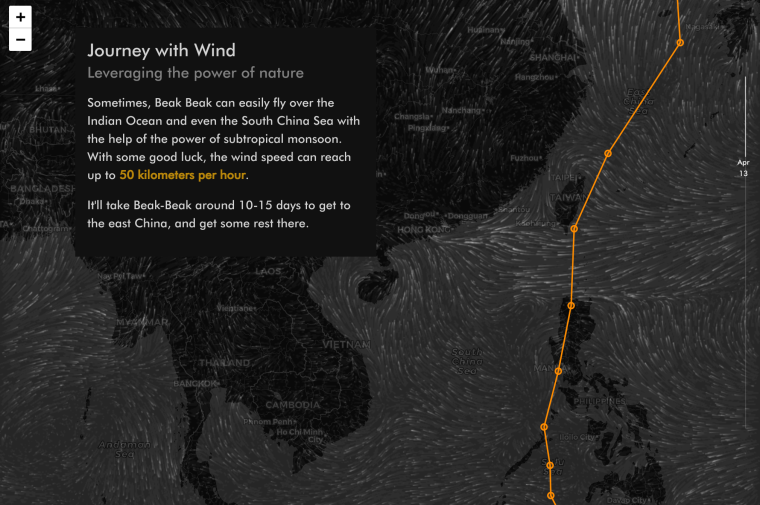 Wader: Great Knot Migration Story
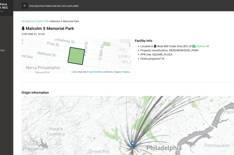 Allocating Programming Resources Using A Mobility-Based Information System
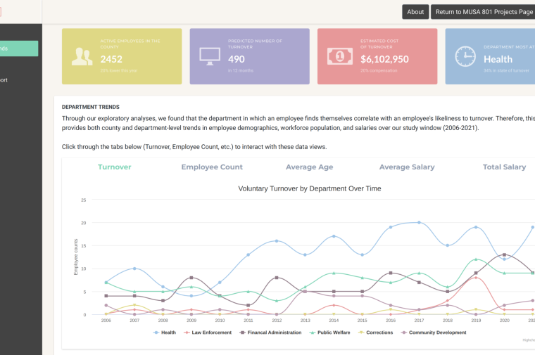 A Human Resources Turnover Risk Intelligence System